The Project
The Project
Maps & Traffic Models
What is the I-49 Lafayette Connector?
The I-49 Lafayette Connector traverses a very heavily urbanized corridor within the heart of Lafayette. Recognizing the significance of this project to the City of Lafayette and the State of Louisiana, the DOTD has initiated a planning and conceptual design study to complete the Functional Plan for the Connector utilizing a Context Sensitive Solutions (CSS) approach.
Currently Proposed Traffic Models
Roundabouts Alternative
Signal Alternative
2021 Refinement Alternative - Roundabouts

2021 Refinement Alternative - Signals

2017 Refinement Alternative No.1

2017 Refinement Alternative No.2

2003 Record of Decision Selected Alternative Map

This map portrays the preliminary design that resulted from the previous phase of the project. The design shown includes geometrics that have not yet been updated to address changes in standards; or local conditions; or the input of the agencies, the city, and the stakeholder working groups. The project locale is not subject to change.
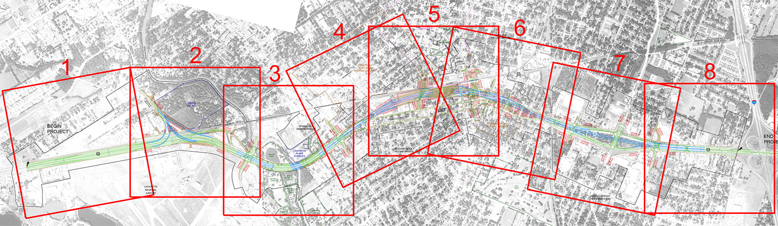
Select a section above to download PDF or below for a larger view.


Profile View from EIS

Context Sensitive Solutions Study Area Map


VIEW ALL DOWNLOADABLE EIS MAPS »
VIEW ALL PROJECT MAPS »